 Version
1.0
Version
1.0
 Package Name
de.intend.android.polterimwald
Package Name
de.intend.android.polterimwald
 Category
Newsletter Social
Category
Newsletter Social
 Size
22.89MB
Size
22.89MB

Easily Find Cluttering in the Forest Using The Coordinates
Find poler places in the unknown area based on the coordinates. " Polter im Wald " shows you the Polterplatz on the map and your own position.
The wooden deployment chain from wooden collection to woodworking operation is still characterized by inefficient processes and a non -continuous flow of information as well as a lack of supportive communication technology. Despite a high number of existing individual solutions of different providers, there is no solution concept tailored to the needs of the individual actors, which supports the operational daily business without media breaks without media breaks.
Trips in well -known regions require a low depth of information. Places and paths are known. The challenge begins when the goal is outside the road network in an unknown area.
The Polter im Wald is the starting point for the wooden industry. Wood buyers and transporters have to find the point in the forest. If the wood seller or the client reports the coordinates of the Polter, the coordinates can be recorded in the app and the polter appears either on an aerial photo, a street map or a topographical map. Your own position is continuously updated via GPS while driving.
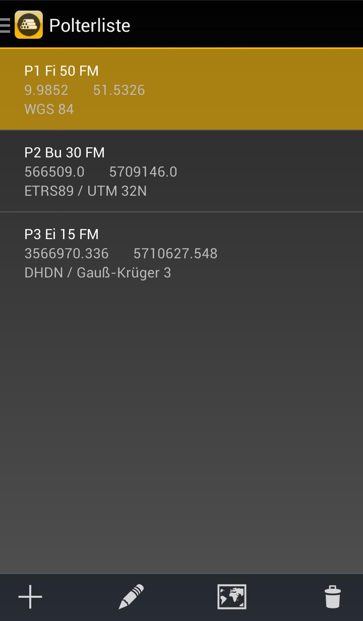
Rumbling
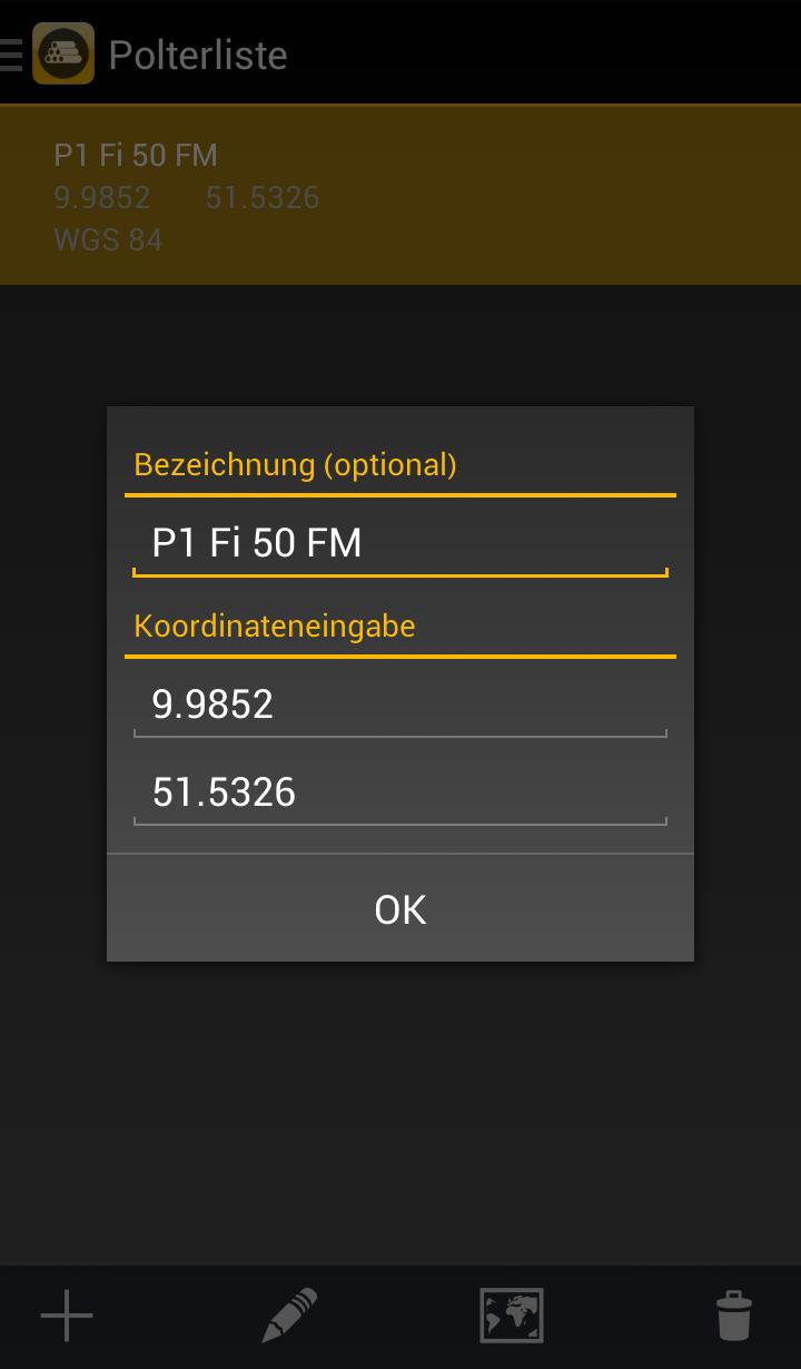
• via coordinate input and manual setting possible on the map
• Polter designation
• Smooth coordinate input without specialist knowledge
• Automatic detection of WGS84, ETRS89 / UTM and Gauß-Krüger
Rumbling overview
• List of polter names with the coordinates
• Selection of individual polt and representation on the map
• Editing existing polt
• Deleting of individual polters
If the smartphone is located by satellite reception (GPS)
• Graphical representation of your own position and the surrounding polter
With network reception of the smartphone (GSM)
• Representation of topographical maps and aerial photo


 Download APK(22.89MB)