 Version
1.26.7
Version
1.26.7
 Package Name
com.jorma.jahtikartta
Package Name
com.jorma.jahtikartta
 Category
Travel
Category
Travel
 Size
26.51MB
Size
26.51MB
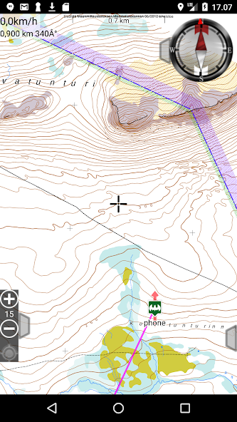

Offline topographical maps of Finland, Sweden and Norway.
Jahtikartta outdoor GPS map is a great application with all the necessary map functions:
• Offline terrain maps of Finland, Sweden and Norway. Offline maps work without a network connection after the first download.
• Your GPS location, location tracking and speed display.
• Compass display with guidance and distance to the destination.
• Saving waypoints.
• Drawing and measuring routes and areas.
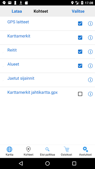
Pro subscription includes:
• Property boundaries as their own map level,
• loading map tiles from the selected area,
• search for coordinates by place name or address,
• Boundaries of Metsähallitus' hunting areas,
• sharing the location between the team and
• GPRS positioning for compatible GPS locators.


 Download APK(26.51MB)